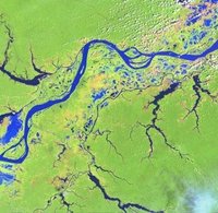
 "Photographs taken from space can track deforestation in developing nations and could be used along with cash incentives to safeguard the estimated 7.3 million hectares (18.04 million acres) of forests -- the size of Panama or Sierra Leone -- lost each year from 2000-2005, according to U.N. data."
"It's quite challenging to get good, cloud-free data but new generation of satellites due in 2012 would improve coverage."
Gaia sighs with relief.
No comments:
Post a Comment